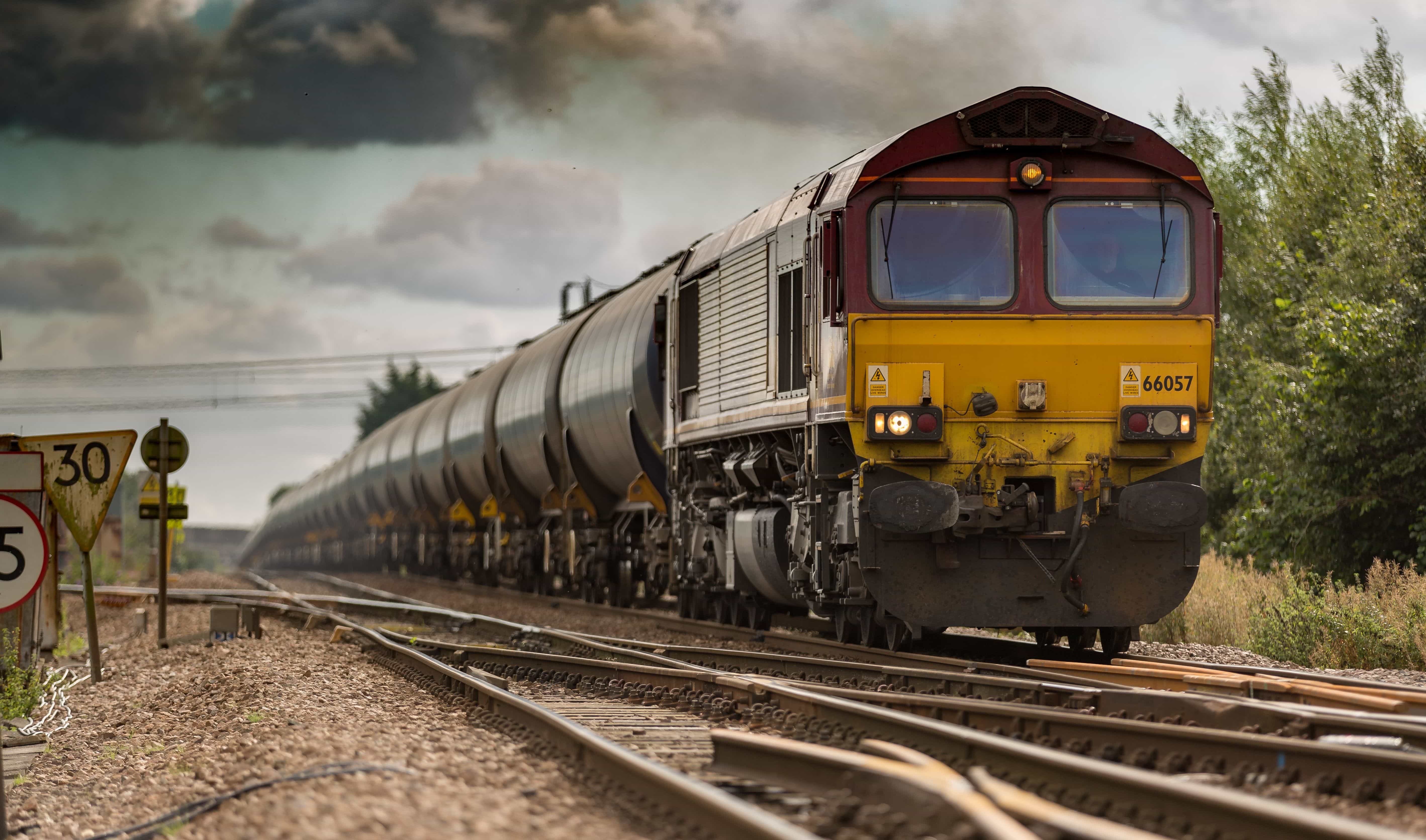
The latest Lat-Lon news. Lat-Lon certifies its own 4G LTE modem with 3G rollback providing the ideal upgrade for older equipment on 2G networks. Additional sensor options for the Compact Tracking Unit will be available in spring, increasing the functionality of this small unit designed to fit in container grooves and other tight spaces. Also, Lat-Lon’s parent company, BSM, acquires Mobi Corp. Mobi Corp specializes in appointment scheduling, route optimization, and analytics software solutions.
2G Sunset Approaching
In 2012 we mentioned that AT&T had announced it would be sun-setting its 2G network by 2017, and some Lat-Lon units would be effected. As that date closes in, we are trying to keep all customers aware of possible changes to unit reporting. Any 2G unit still active, is noted on invoices “This unit may stop reporting as of January 1, 2017 due to the AT&T 2G network shutdown. Lat-Lon will apply the remaining data service towards a 3G replacement unit or refund the balance. Please contact Lat-Lon with any questions.”
If you have an older unit, please verify that it will continue to report after December 31st, 2016 by reviewing your latest invoice or contacting Amy Boehm at aboehm@www.lat-lon.com or 303-937-7406. Please note, any units containing an alpha-numeric number (example: A100012B34C5) are CDMA units and will not be impacted by the shutdown.
Lat-Lon Oct 2016 Newsletter
Lat-Lon news and updates. Learn more on how to use big data to protect your assets and grow efficiencies with Lat-Lon’s Big Data Analytics in Rail whitepaper. Adaptive device configuration, available on STUs, can now disable/enable alerts to help you get alerted when you want to and not when you don’t. As far as products, a reminder that our Locomotive Monitoring Unit can have an added feature to automatically start and stop your engines, reducing unneeded idle time and we have recently introduced the Compact Tracking Unit, a slimmer version of our Solar tracking Unit.
Mesh Networking
Background
Mesh networking is a technology originally developed by the military for use in battlefield communications. In a mesh network, nodes (or devices) are setup in a way that allows for many communication paths to reach one desired access point. You can see how this is helpful in military communications, as mesh technology improves surveillance, tactical planning, targeting accuracy, and troop safety in the battlefield by establishing a communication network without the need to set up large towers or antennas for signal. Mesh networking has quickly been adapted and is now commonly used in various industries, including Logistics.
How It Works
Mesh networking is a means by which data is transmitted along a path (think of a bucket brigade) made up of dozens or even hundreds of nodes that “talk” to each other, versus using a traditional wired network that relies on a small number of wired access points or wireless hotspots to connect users. The nodes in a mesh network work together to transmit data over larger or harder to reach geographic areas. Each node passes data long to the next node and the next node until it reaches the intended destination, either the end user or a transmission hub. The data is encrypted as it travels, allowing only the intended user to receive the information.
Advantages
1) Self-Governing and Adaptable
An advantage of a mesh network is that it is self-governing. This allows the network to self-create and also self-heal. If one node should go offline or become unavailable because of hardware failure or lack of power, it will reroute to the next available node and the data transmission can successfully continue. The data is programmed to seek the fastest path to its destination, allowing the network to go around any points that have become unavailable or use any new nodes added to the mesh network.
Additionally, nodes can be removed or added as more or less coverage is needed. An amusement park, for example, might need additional nodes and coverage added because the large structures and rides may occasionally block the signal from reaching the end access point. In areas such as these, adding more nodes will adjust the communication to find a clear signal.
2) Lower Costs
Using fewer modems and wires mean lower costs for set-up and data charges. Wireless mesh networks share a network connection across a large area while using less equipment and providing easy installation.
3) Coverage of Large Geographic Areas
Because mesh networks are reliable, high speed, and provide instant connectivity, they are suited and designed to support coverage over large indoor or outdoor areas. A variety of public safety applications such as parking garages, campus grounds, schools, business parks, and other large outdoor facilities rely on wireless mesh networks to provide connection.
CDMA & GSM Cellular Technologies
Q&A on CDMA & GSM Cellular Technologies
Q: What are GSM & CDMA and how are they different?
A: Both GSM and CDMA are global standards for cellular communication and represent the two major radio systems used in cellular technology. The main difference between GSM (Global System for Mobile) and CDMA (Code Division Multiple Access) technology is the way data is converted into radio waves and how the frequency bands are divided, as well as their global reach and coverage. Both accomplish the same goal: cellular communication for cell phones and other devices that use wireless technology.
Q: Which is better?
A: Both networks have different advantages, depending on geographic location and who your carrier is. When it comes down to it, the quality of the network is more important than the subscribed technology. Factors such as area coverage, customer service, data transfer speed etc. are a better determinate of what technology/carrier is the best fit.
GSM is the dominant technology in most of the world, but CDMA happens to be a major source in the US market specifically. Carriers such as Verizon and Sprint use the CDMA technology and AT & T and T-Mobile use the GSM standard. Each carrier offers a variety of data transmission speeds on each network, known as 2G, 3G, or 4G.
Q: What does this mean for Lat-Lon customers?
A: Previously, Lat-Lon products used GSM 2G, or Second Generation Wireless, networks. AT&T announced that it will be shutting down 2G networks by 2017 and filed with the Securities and Exchange Commission to shut down these networks as it continues to upgrade its systems to faster technology and better use its limited airwaves.
Q: What will happen in 2017?
A: The deadline may possibly be extended, but when the 2G network is shutdown, any unit still transmitting in 2G will no longer be able to communicate. For more information on the shutdown, check out our blog. If you are wondering if your Lat-Lon unit has been affected, please refer to your data invoice or contact Amy Boehm at aboehm@www.lat-lon.com.
Hazardous Location Equipment Requirements
OSHA Publication 3073 defines a hazardous location as follows: “Hazardous locations are areas where flammable liquids, gases or vapors or combustible dusts exist in sufficient quantities to produce an explosion or fire. In hazardous locations, specially designed equipment and special installation techniques must be used to protect against the explosive and flammable potential of these substances.”
When operating equipment in these hazardous locations, it is important and required that the equipment has been held to a certain level of safety standards. OSHA, the NEC, CEC, and the National Fire Protection Association (NFPA) regulate hazardous locations into a Class/Division system. The classes define the type of explosive or ignitable substances that are present in the atmosphere. Each class is then subdivided into divisions, which define the likelihood of the hazardous material being present in a flammable concentration. In order to appoint a product to a certain class and division and approve it for production, a thorough study and completion of tests must be done. One of the most common hazardous location certifications is the Class I, Division 2 certification. So what exactly does that certification entail?
The NFPA Publication 70, NEC, and CEC define Class I locations as those in which flammable vapors and gases may be present. Class I, Division 2 locations are those in which flammable liquids or gases are handled or used, but are normally confined within closed containers or systems. This means that these vapors and gases can only escape if there was an accidental rupture, breakdown, or abnormal operation of the equipment. For example, the area outside of or beside a gas pump would be a Class I, Division 2 hazardous location because there are no ignitable concentrations of the gasoline in that area. The gas tank is below ground and has a very unlikely chance of escaping and causing an explosion. The actual tank underground or on the truck, however, would not be a division 2 location because the tank directly holds ignitable concentrations of flammable contents and an explosive atmosphere could happen in normal operating conditions. (see Figure 1)
It’s nearly impossible to eliminate electrical equipment from a hazardous location. When proper precautions aren’t taken, dangerous scenarios are more likely to happen. To prevent explosive and flammable situations, make sure all equipment is specifically tested and approved to work in environments where hazardous conditions exist.
Lat-Lon, LLC Launches Adaptive Device Configuration
Traditionally, users of GPS tracking devices would need to closely monitor and manually change the configuration of a device. For large fleets, this task can be overwhelming and time prohibitive. ADC makes it possible for users to easily manage reporting configuration and get automatic updates based on location, weather data, proximity to set points, unit status, and sensor input.
ADC users can add “if-then” logic at the back-office level that allows a unit to react to data. This creates efficient, customized reporting which allows customers to track their assets even closer at critical times. For example, once a device leaves a specific geo-fence, reporting frequency can change to automatically update every ten minutes. Additionally, if it is sunny and the unit has a strong charge, reporting frequency can increase to every minute.
Dave Baker, President of Lat-Lon says “The natural progression of IoT is to add a layer of feedback to the units in the field so that they can automatically reconfigure based on changing conditions both local to the units as well as any other sources of data, such as the internet or business operational considerations.”
Lat-Lon’s goal in creating ADC was to improve the “SMART” technology by taking out the manual steps in the configuration process. This is beneficial for customers because they receive more timely data, reduce their work load, and increase their productivity.
Lat-Lon, A BSM Technologies Company, is expanding the use of ADC in-line with customer needs and deployment situations. The ADC is compatible with the latest version of Solar-Powered Tracking Units (STU’s) and Compact Tracking Units (CTU’s) by Lat-Lon.
About Lat-Lon: Lat-Lon, LLC was founded in 1999 in Denver, Colorado and provides wireless GPS tracking and monitoring solutions for assets. Lat-Lon’s key products include a solar-powered GPS monitoring system (STU) for railcars and trailers that allows fleet managers to know the condition and location of their assets at any given time, a compact tracking unit (CTU) for track and trace capabilities, and a locomotive monitoring unit (LMU). For further information contact Lat-Lon at 877-300-6566 or visit www.lat-lon.com Lat-Lon is owned by BSM Technologies Inc. (Toronto, ON) Stock Symbol: TSX-V:GPS.
4G LTE, A Summary
4G and LTE are actually separate terms used together to define the fastest available mobile data technology. 4G is a term that is used to describe the 4th generation of network technology. LTE is the term used for the “long term evolution” of this technology and generally refers to the improvement of wireless speeds to meet increasing demand. As defined by International Telecommunications Union-Radio communications sector (ITU-R), 4G peak speed requirements are 100 megabits per second (Mbit/s) for high mobility communication (such as trains and cars) and 1 gigabit per second (Gbit/s) for low mobility communication (such as pedestrians and stationary users).[
4G and 4G LTE replace earlier versions of data technology, such as 2G and 3G. A 2G network can transmit up to 50,000 bytes/second and a 3G network can transmit up to 4 million bytes/second. Megabyte is the file size and megabit is the download speed. Most importantly, a megabit is 1/8 of a megabyte, so if you are downloading a 1 megabyte file an internet speed of 8 megabits per second (Mbit/s) allows you to download the file in 1 second. The 4G LTE network is providing a much faster and cleaner data transmission due in part to a redesign and simplification of the network. Using 4G LTE communication capabilities will provide increased data transmission speeds of anywhere between 5 and 50 times the 3G network.
4G networks use a different frequency than 3G networks to transmit data. The increase in speed is due in part to being able to condense more data into the same amount of radio frequency. Data is split up and sent in small pieces at the same time, thus increasing the network ability. As technology advances, we are experiencing mobile data speeds that rival or sometimes exceed broadband connections. This allows us to use data much more reliably and consistently in mobile applications. This also permits the transfer of much more data from a remote location.
For the specific purposes of machine to machine (M2M) devices, the actual transmission speed is not the critical concern as much as coverage. As we are quickly approaching the sunset of AT&T’s 2G network (including M2M applications), it is imperative we look at the best way to maintain our coverage. An average data packet from a Lat-Lon Solar Tracking Unit (STU) is 256 bytes, thus bytes/sec is more than ample even with the “old” 2G. But given the shutdown of the 2G network by AT&T it is necessary for us to upgrade our systems to ensure proper tracking of our Lat-Lon Solar Tracking Units.
Is this the end of the line, of course not! As technology continues to develop we will eventually see a 5G, 6G, etc. to continue to enhance our data communication abilities. At this point the timeline for 5G technology is still a work in progress, as are the exact definitions of what the future generation of network technology will hold for businesses and consumers. For the foreseeable future, 4G LTE is the optimal network with the broadest coverage for Lat-Lon Solar Tracking Units.
Lat-Lon June 2016 Newsletter
Lat-Lon announces the Compact Tracking Unit, a new solar-powered unit designed to fit in small spots such as the grooves of a container. It is similar to our legendary Solar Tracking Unit and has many of the same features. Also new, is a feature for our Solar Tracking Units called Adaptive Device Configuration. This changes the reporting frequency for units so you’ll receive more messages when you want to without any real-time work. Another inclusion is a recap of our Big Data Driving Rail Decisions FastCast.
Perspective: From M2M to Rail IoT and Big Data Analytics
Machine to machine (M2M) technology isn’t new to the rail industry, but it has now broadened into the Internet of Things (IoT) and Big Data analytics. Railroads and their customers are benefitting today, and there is still room for growth and the realization of new benefits.
Real-time satellite image with moving assets as icons
Railroads are benefitting because, with the rise of IoT, we’ve actually seen a decrease in safety incidents. The train accident rate in 2014 was the lowest ever, down 79 percent from 1980, and 43 percent from 2000. With the implementation of things like positive train control (PTC) and closer monitoring of driver fatigue, we hope to see this trend continue.
Another advantage IoT provides for railroads is related to the heightened visibility IoT provides: Railroads no long bear sole responsibility for lost, delayed or damaged shipments. A railroad can now share accountability with shippers and equipment manufacturers, given the range of tracking and reporting systems that not only can trace a problem, but also enable prevention.
IoT also is being used to drastically bring down the costs of operations with, for example, new technology such as mesh networks for tracking and monitoring railcars. By using less hardware and data to elicit valuable information — information such as rapid acceleration, impact detection, and hatch-openings on each individual car — railroads can secure and optimize their operations at steeply reduced costs. Being one of the primary modes of transportation within the country, this helps railroads optimize their efficiencies and increase their output at a better profit margin.
For railroad customers, optimized efficiencies bring down the cost of goods transferred. In the end everyone is happy.
How M2M has evolved
The natural progression of M2M communications was to create an even smarter machine-to-machine relationship, with information coming back again, generating a conditional environment. So instead of a machine simply reporting to another machine, they each can understand adjustable criteria and use it to modify their interaction. Lat-Lon, a BSM Technologies Company, is undergoing this transformation with its systems so that each machine is adaptive to each other’s activities, creating a symmetrical relationship. For example, once a shipment leaves the railyard on a truck, both the railyard system and the truck report more frequently.
The heightened visibility mentioned earlier is afforded by global positioning system (GPS) tracking devices. Since 1999, Lat-Lon has been accumulating a broad range of success stories on how this type of M2M communication delivers safety, efficiency and fiscal results to Class 1s, short lines and shippers. In 2014, Lat-Lon was acquired by global asset tracking leader, BSM Technologies. The combined product array completes offerings for all tracking and monitoring needs in the rail industry.
As technology has evolved, so have the BSM Technologies products, providing a host of sensors that offer relevance to events with GPS data. Applications include the detecting of damaging impacts, identifying “Man Down” equipment, flat wheel sensors, truck hunting input and more.
Specific IoT applications
One major chemical shipper used Lat-Lon GPS with Impacts Data to determine algorithm issues specific to a particular track in an automated yard. This customer was able to determine that a decimal point had been misplaced in an automated sorting yard application, after discovering consistent large impacts on one track.
A short-line railroad is saving more than $1,750 per week in idling fuel per locomotive during winter months with the Lat-Lon Automatic Engine Start Stop application. Lat-Lon AESS lets updates to engine start/stop parameters be made over-the-air, so this railroad can make adjustments quickly and easily when business needs dictate.
A Class 1 railroad wanted to reduce their claims for spoiled produce. Through 24/7 temperature monitoring, this customer was able to prove that their refer cars had been functioning correctly; one particular destination was incorrectly claiming spoilage.
Most recently, an existing Lat-Lon customer wanted to concisely improve visibility and efficiency without eroding safety. They conceptualized a two-screen system to display all moving and stationary assets within their yard, but on a budget. The customer reached out to Lat-Lon and the Connected Rail Yard was born. The connecting of all rail assets in a yard — from crew to moving equipment to fixed assets — is the epitome of IoT.
For this connected railyard, Lat-Lon harnessed Mesh technology to create a scalable and reliable network with high-frequency transmission capabilities. Sensors installed on switches and derails within the customer’s yard pass data along like a bucket brigade, creating a network with multiple paths to each access point. The Solar-Powered Access Point (AP) unit contains a modem that uploads the data to secure servers and train dispatcher screens. That means this customer has fewer modems deployed throughout their yard, while gathering all required data.
In this railyard, moving assets were equipped with a self-contained Solar-Powered Tracking Unit or Locomotive Monitoring Unit. The Connected Rail Yard data is collected on secure servers, and data analytics creates displays on two large, high-definition monitors in the dispatch office. One monitor shows a real-time satellite image with all moving assets as icons. The second monitor shows a custom schematic Rail Yard Control screen (Tracks) with all stationary sensor icons. Each icon is a relay from MeshRF sensors or standalone units deployed within the yard. The dispatch office screen indicates when a switch in the normal, diverting position, or unknown status.
With Lat-Lon and BSM together, the customer can monitor all assets within the yard. The Connected Rail Yard application is an efficient, at-a-glance tool for this customer to resolve bottlenecks, improve throughput and maximize resources.
Robyn Kline is Director of Marketing for Lat-Lon LLC, a BSM Technologies Company. With a host of sensors and specialty monitoring for rail and intermodal shipments, Lat-Lon provides more than GPS. Since 1999, Lat-Lon has established itself as an innovator. It gained further momentum in 2014 when acquired by BSM Technologies, a global asset tracking leader. The Lat-Lon self-contained Solar Tracking Unit dominates product lines, and is complimented by powered units for locomotives, a variety of rail-specific collaborated sensors, and thorough hy-rail & rubber tire solutions from BSM. Find out more by viewing the Connected Rail Yard video or the Lat-Lon/Progressive Railroading Fast Cast on Impact in Rail.